
Services / Gravity
Airborne Gravity with AIRGrav
Sander Geophysics Limited (SGL) offers airborne gravity surveys using our Airborne Inertially Referenced Gravimeter, AIRGrav. SGL AIRGrav is the only purpose-built airborne gravimeter, designed specifically for the unique characteristics of the airborne environment. This design approach has resulted in a superior gravity instrument which can be flown in an efficient survey aircraft during normal daytime conditions.
How the system works
The AIRGrav system includes an all new gravimeter on a three-axis inertially stabilized platform, combined with high resolution Differential GPS (DGPS) to correct for aircraft movements due to turbulence, aircraft vibrations and drape flying. The gyro stabilized inertial platform makes the gravimeter much less affected by horizontal accelerations than other systems, which use modified sea gravimeters. This allows AIRGrav to achieve consistently higher resolution.
AIRGrav was designed primarily for petroleum exploration, where it is an economical alternative to ground and shipborne surveys. It also has exciting application in regional geophysics, mineral exploration and geodesy. The system is available to fly fixed-wing or helicopter surveys, and can easily be flown in combination with magnetic and radiometric instruments.
Terrain corrections are performed using either an existing digital terrain model or terrain data acquired in the course of the gravimetric survey. Airborne gravity does not require near station corrections, and is not susceptible to errors due to anomalous densities near a gravity station.
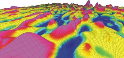
Typical AIRGrav survey parameters
Accuracy and resolution depend on aircraft speed and line spacing. The relationship can be traded off depending on the client objectives.
| Accuracy RMS (mGal) | Resolution, half sine wave (m) | Aircraft | Velocity (kt) | Line spacing (m) | Production rate (km2/day) |
|---|---|---|---|---|---|
| 0.2 | 4,000 | Fixed wing | 120 | 1,000 | 500 |
| 0.2 | 2,200 | Fixed wing | 95 | 300 | 150 |
| 0.2 | 1,100 | Helicopter | 50 | 200 | 100 |
| 0.2 | 700 | Helicopter | 35 | 50 to 100 | 30 |
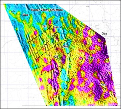
Case study: Turner Valley, Canada
Sander Geophysics completed a combined gravity and magnetic survey in the Turner Valley area, south of Calgary, Canada. The data set consists of over 12,000 line km of data flown on 250 m spaced east-west lines, and 1,000 m north-south lines. The extent of the data set is 60 km from north to south.
Noise was calculated to be 0.3 mGal. Gravity anomalies of less than 2 mGal can be seen clearly on the data set and correlate well with known oil and gas fields.
Production surveys have been flown under a variety of conditions including offshore, at a constant altitude over rolling terrain, and with a loose drape over high mountains above 3,000 m. Because the system is relatively tolerant of turbulence, it works well on drape surveys and in moderate to severe turbulence.
The survey, drawn as it flies
Parallel lines, evenly spaced, flown low and steady: the grid is the product. Run the diagram to watch a block being measured.
Included
Survey planning, data acquisition, and preliminary processing in the field.
Delivered
Final data processing to terrain corrected Bouguer gravity, and a comprehensive technical report.
Interpretation
Integrated interpretation of AIRGrav, aeromagnetic and other data sets.
Next step
Read the published record
Two decades of AIRGrav papers, from the system first results to a 2023 PNAS study using SGL gravity data, are indexed in Resources.